King County First Annual Drone Summit
King Street Center - 6th floor
February 24, 2026
Summit Goal

- Share Knowledge
- Explore Benefits
- Discuss Use Cases
- Network
- Questions and Discussions
Thank you to all the presenters and participants.
Schedule
- Morning Session: General & Use Cases Panel Discussion
- 9:30 - 11:45 AM
- Afternoon Session: Panel Discussion & Esri Presentation
- 1:00 - 3:00 PM
The Sky's the Limit: KC Wastewater Drone Program To Support Sustainable Infrasture.
Peter Keum, GISP
WTD Drone Program Lead/GIS
WTD Drone Program
We Came, We Flew Up, Up and, We Mapped..

OR
From Buzz to Business
* Introduction: Background Information
* Why & How & What (WTD GIS)
So Let's Dive in!

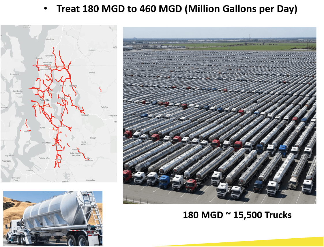
King County Wastewater Treatment by Numbers
-
2 million residents
-
34 Agencies
-
424 square miles
-
383 miles sewer pipeline (2.5 inch to 14 ft)
-
74 facilities (PS & RS)
-
3 Treatment Plants: 180 MGD ~ Max. 460 MGD

Seattle, WA --> Medford, OR
Brightwater TP
WTD GIS Team
-
10 GIS Specialists
-
4 FAA Certified Pilots
-
3 Studying to be Certified
-
Two Interns
-
Olivia
-
Max
-
Supervisor

WTD GIS
Maintain Sewer GIS Data
-
FIRS (Facility Information Retrieval System) Data
- Maintenance Hole
- Pipes
- Pump Stations
- Regulator Stations
- Treatment Plants
- Outfalls
- Flow Monitors
- CP Stations
- Connection Points
- Site Plan Data
- 3D Models
- Drone Collected Data
- .... many many more

WTD
GIS
DATA
GIS Data:
The core of a GIS is its Database
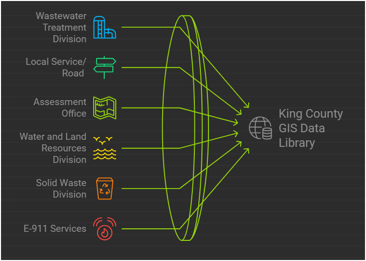
BUT.....There are 17 county agencies support
King County GIS Data Library System
WTD
GIS Data:
The core of a GIS is its Database
- Price /Performance
- Easy to use
- Quality data collection
- FAA regulation

Why Now?
Popularity & Advancement of Drone
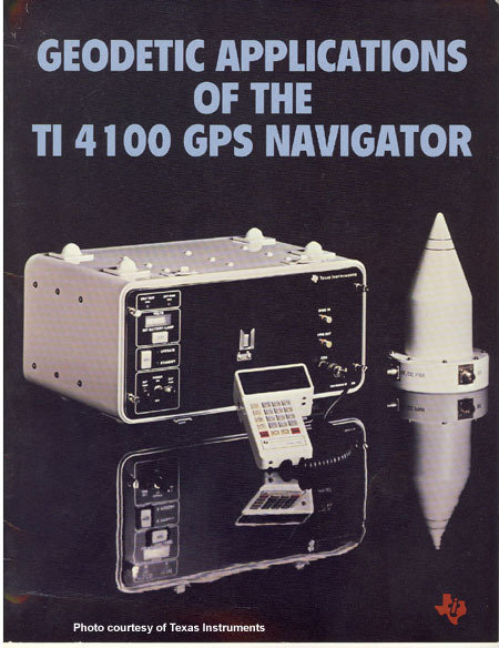
Integrated gyroscopic/GPS Chip in 2000's = $10,000
In 2017 = $3

1981 $120,000
2013
$5 - $15
In 2025 = $3 (??) less than $1
Cell Phone Technology + Lower $$
- Electronic Control System (ECS)
- Accelerometer & Gyroscope Chip
- GPS Chip
- Lithium Polymer (LiPo) Battery
- Motors


It's just a toy...

2016


It's just a toy...


2007
2010

So Where is it going...
-
Increase in Enterprise use of Drones
-
Using them because drones do job better
-
-
Successful technology is not thrill but becomes essential and accepted
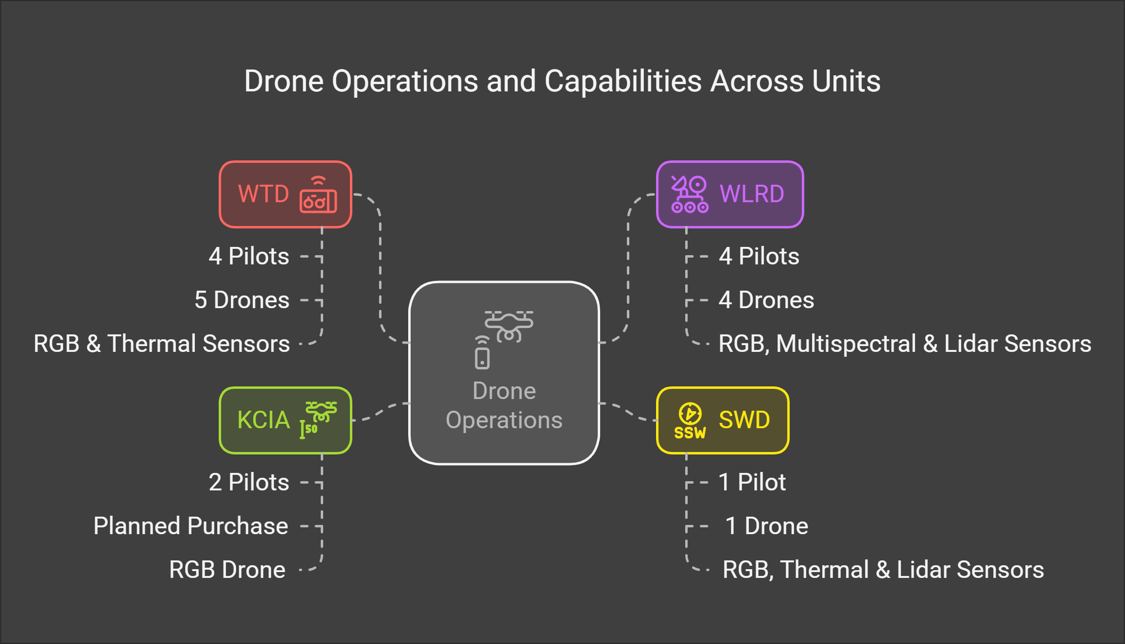
WTD GIS Drone Program
February 2026
- Four FAA Part 107 Drone Certified Pilots - WTD GIS Specialists (Jim, Patrick, Joe, and Peter)
- Assisting other departments to stand up their own drone programs (WLRD/ SWD/ Local Service/ KCIA/ FMD)


Joe
KC Wastewater Treatment Drone Program

People
+
Technology
+
Organization
=
Drone Program
RPAS - Remotely Piloted Aircraft System
FAA Definition: Remotely piloted Aircraft system operated by a pilot via ground control or on-board computer.


Background Information
RPAS Categories

Small
- Size: 1 - 2 meters ( 3 ft - 6.5 ft), < 55 lbs.
- Control: Visual line of sight, Radio control
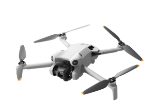
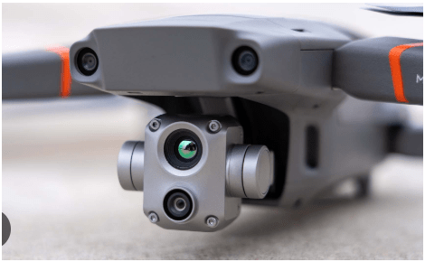
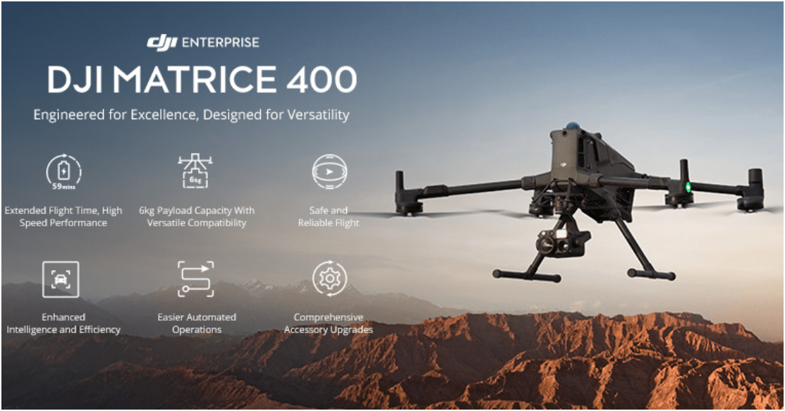
- DJI M3E, M400, ScanEagle
Medium
- Size: Equivalent to a car, ~ 1000 lbs.
- Control: Visual Line Of Sight (VLOS) & Beyond LOS, RC & Satellite
- General Atomics -MQ1 Predator
Large
- Size: > 30,000 lbs.
- Control: Visual Line Of Sight (VLOS) & Beyond LOS, RC & Satellite
- Northrop Grumman RQ-4 Global Hawk ~$222 Million

RPAS as Platform
Multi-rotors
Fixed-wing & VTOL

- Shorter flight time (< 45 min)
- Cover smaller area
- Highly maneuverable
- Less expensive
- Access to confined spaces
- Long flight time (+ 40min)
- Covers very large area

(vertical take-off & land)

Sensors Payload

Multi-spectral
Thermal Infrared

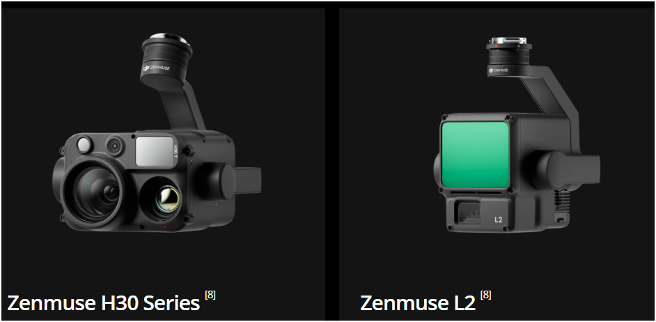
Lidar Camera

High resolution digital camera (100 MP)

Methane Gas Detector

Sensors Payload
High resolution digital camera


Sensors Payload
LiDAR Sensor - aka Laser Scanning
Outdoor
Indoor


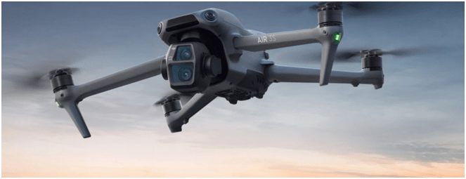
DJI Air & Mavic 2 Pro < $1800
Aertos 120 $25,000 +
Eilos 2 $48,000 +
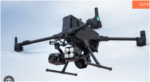
DJI Matrice 300 $12,000 +


Outdoor
- GPS Signal
- Automated Planning and Flight
- Even, Diffuse lighting
- Open space
Indoor
- No GPS signal
- Limits on speed and motion
- Manual flight control
- Tight spaces
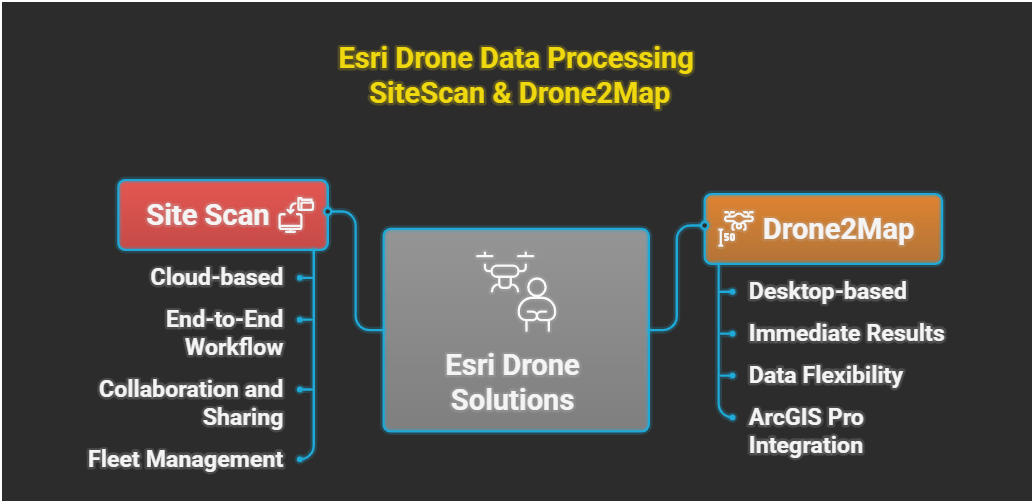
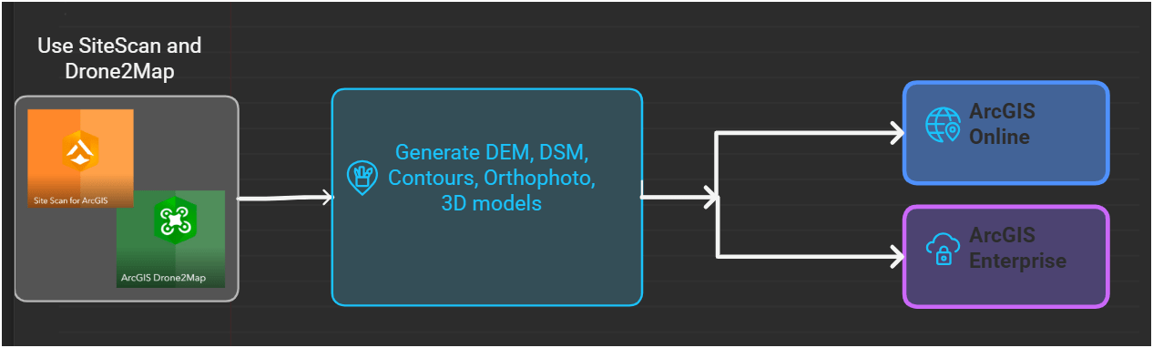
1. Aircraft + Sensor (Data Collection)
2. Data Processing & Analyzing (GIS)
3. Information Products
=
+


1. Platform + Sensor (Data Collection)
2. Data Processing & Analyzing (GIS)
3. Information Products


Standard Drone Workflow

Drone

GIS
Great Combo?
&
Great combo !
GIS & DRONE


Great combo !
GIS & DRONE


FAA Regulations - Where are we now?

Regulations
-
Be at least 16 yrs old
-
Pass the initial aeronautical knowledge exam
-
Online recurring training every 24 month
-
Understand recreational flying requirements
-
Take TRUST
-
Online recurring training every 24 month
Commercial/Governmental
FAA Part 107 Rule, July 2016
-
Need FAA Remote Pilot Certification (Pilot license NOT needed)
-
~460,375 - Remote pilots certified (Oct. 2025)
-
~433,407 - Commercial Drones Registered (Oct. 2025)
- $175 to take the test
-
Fly under 400 feet above ground level
-
Not to fly < 5 nautical miles around airport
-
Aircraft < 55 lbs.
-
Fly during daytime or night time operation with appropriate lighting
-
Fly visual line of sight ( VLOS)
-
No flight over non-participating people
- ...and many, many more.....
FAA Part 107 Rule
Hobby/Recreation
-
Self register (over 13 yrs old)
-
Fly under 400 feet above ground level
-
Not to fly < 5 nautical miles around airport
-
Aircraft < 55 lbs.
-
Fly during daytime
-
Fly visual line of sight ( VLOS)
- Less than 250 grams (0.55 lbs) - No need to register with FAA
- More than 250 grams register with FAA $5.00
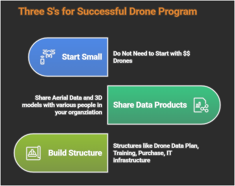
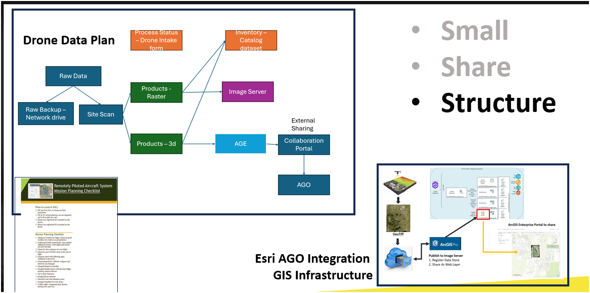
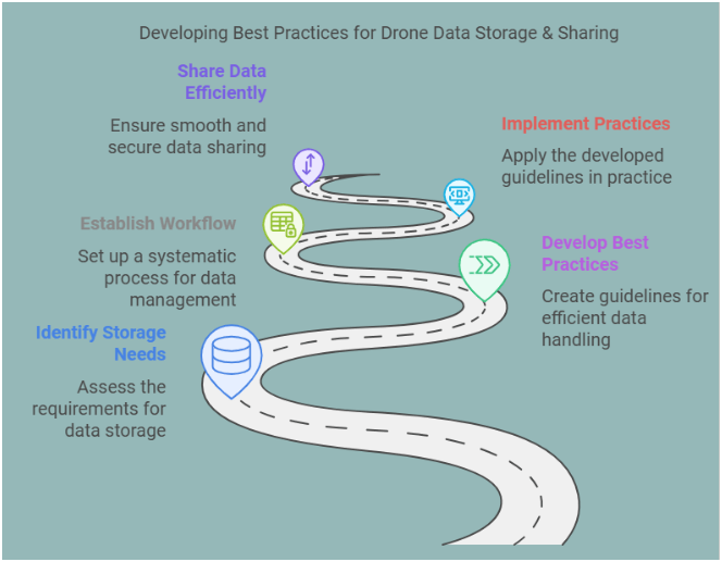
Building Drone Program
E3S3
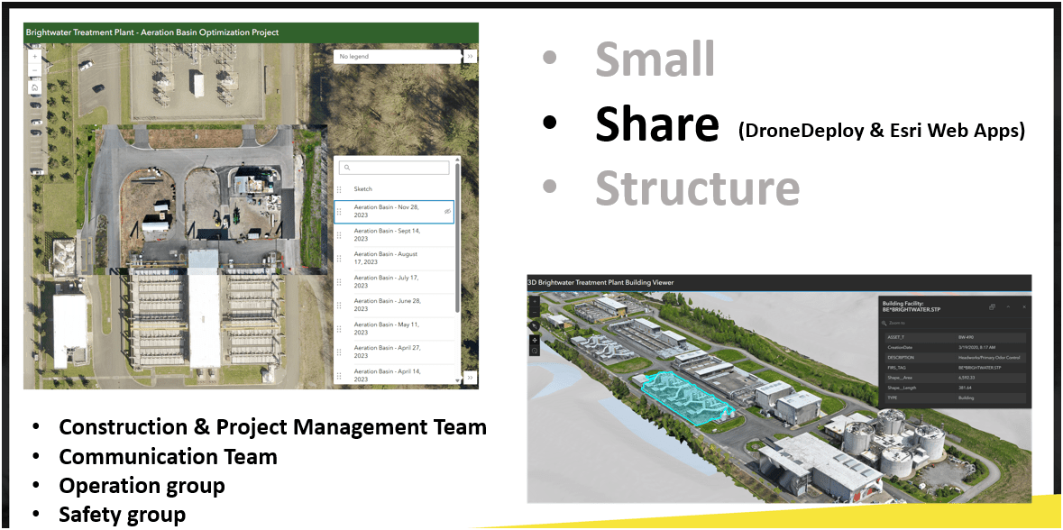
-
Small
-
Share
-
Structure
Easy
Efficient
Effective
HOW
WHY?
- Ensure Continuous Operation
- Support Capital Delivery & Maintenance
Why Use Drones?
1. Easy - Simple with little effort

Automatic
Repeatable
E3
Flight Control App
Automate Flight Planning - Fly Consistently for overlapping images
Can fly manually but it's like mowing with scissors


Why Use Drones?
2. Efficient - Results without waste
Safety of staffs & Save Time & $$

E3
Inspecting Inside Digester (2024)
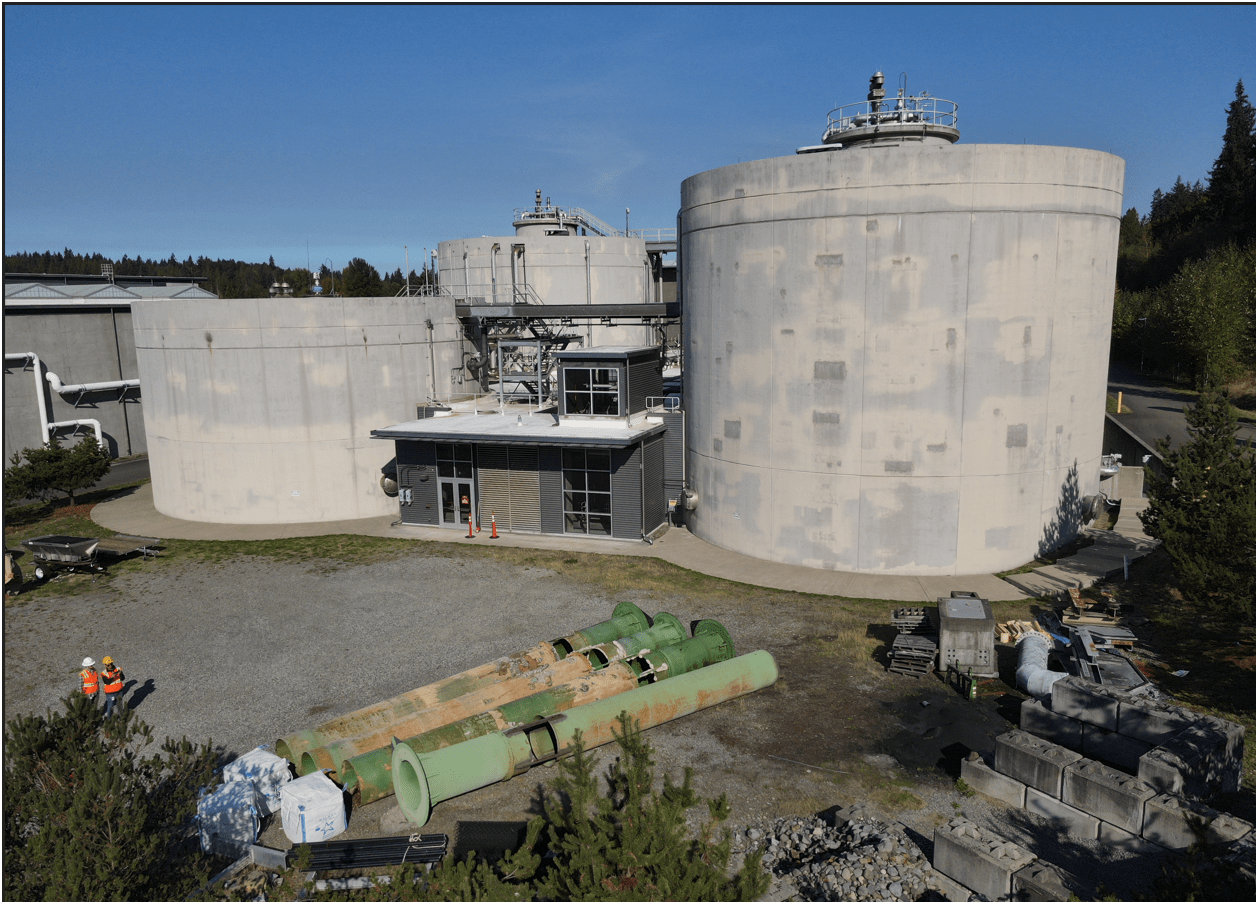
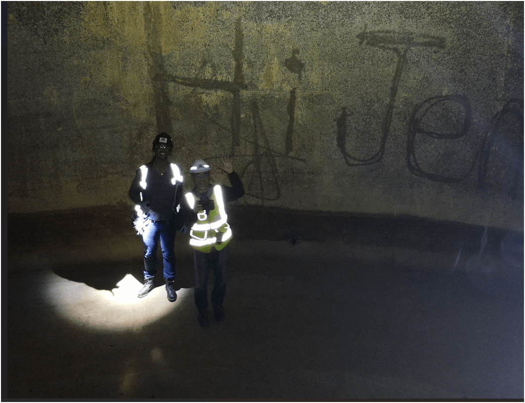
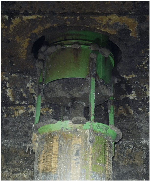
Inspecting Inside Digester
Safety of staffs & Save Time & $$
Why Use Drones?


South Treatment Plant
Primary Division Channel
Increase Safety for Staff
2. Efficient - Results without waste
Safety of staffs & Save Time & $$
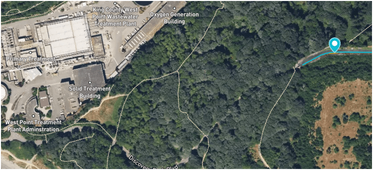
West Point
Treatment
Plant
Discovery Park
Blvd
Dec 2024
E3
Why Use Drones?
3. Effective - Producing Results


E3
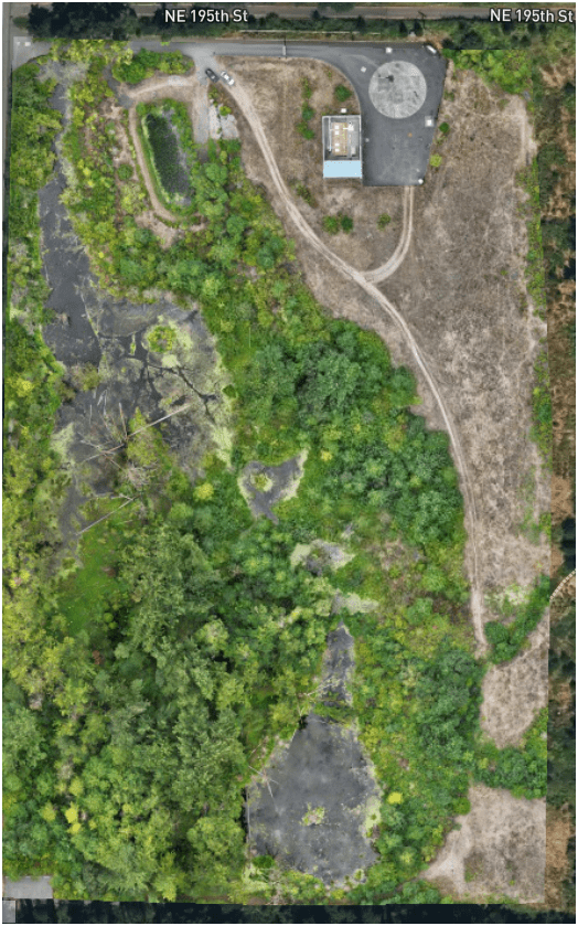
Update 2D aerial map

0.57 in/px
Sept 2023
3.0 in/px
2023 KC Aerial
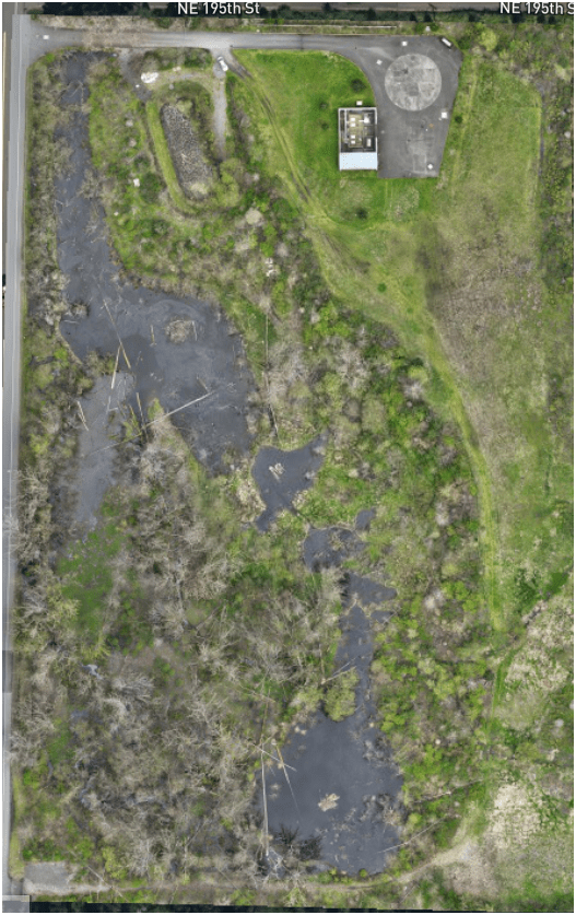
3. Effective - Producing Results
E3
0.50 in/px
June 2025
6x time the resolution
(from KC Aerial Imagery - June 2025)
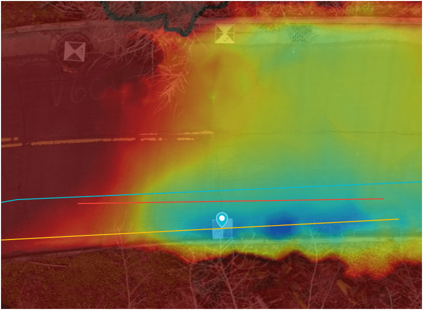
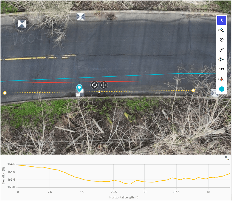
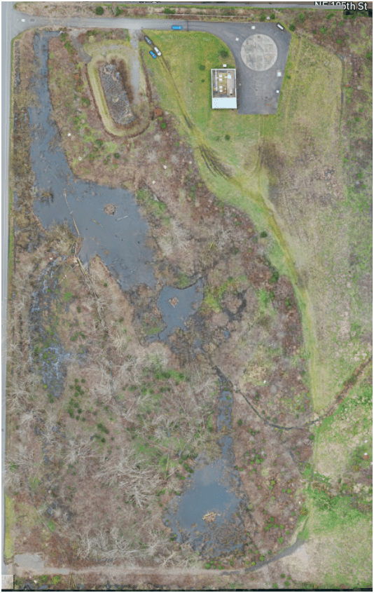
Monitoring & Mitigation (ECSS)
March 2022
April 2024
August 2025
3. Effective - Producing Results
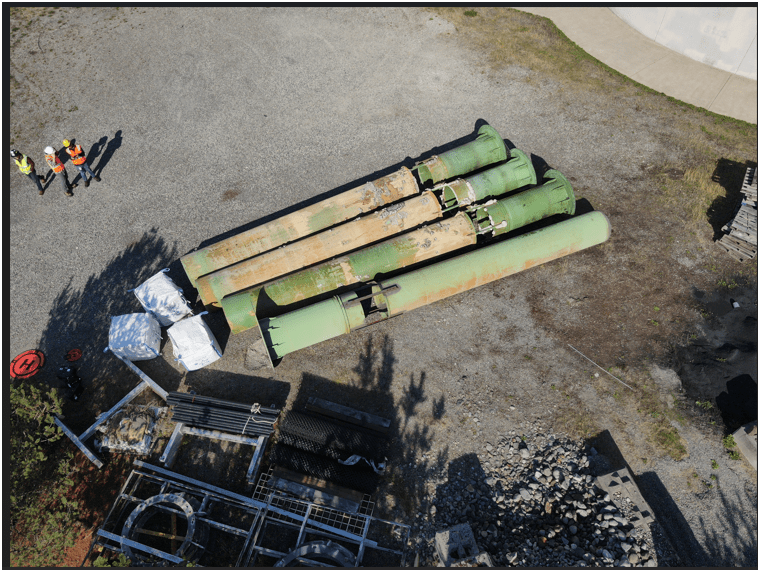
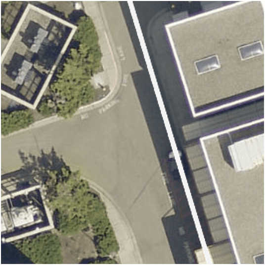
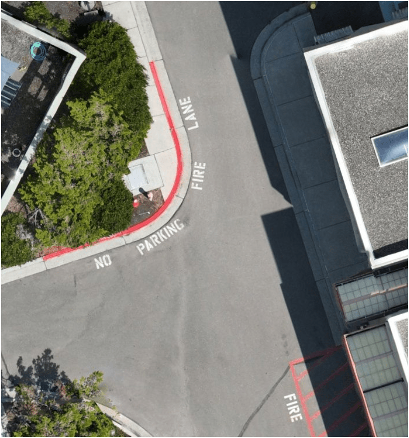
E3
Construction Site Monitoring
3. Effective - Producing Results
E3
Construction Site Monitoring
3. Effective - Producing Results
E3
Ship Canal Water Quality - TBM
3. Effective - Producing Results
E3
Heat Resource Recover - Energy District (Dexter Ave)
3. Effective - Producing Results
E3
Building Drone Program
E3S3
-
Small
-
Share
-
Structure
WHY
-
Easy
-
Efficient
-
Effective
HOW
WHY?
- Ensure Continous Operation
- Support Capital Delivery & Maintenance
DJI Mavic 2 Pro (1)

Mavic 2 Ent. Adv. (1)

Mavic 3 Ent (2)
2021
2022
2023
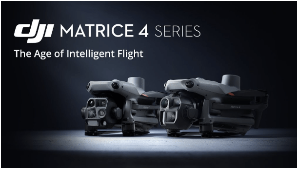
Matrice 4 Ent. (1)
2025
Total: < $22,000
-
Small
-
Share
-
Structure
S3
$1,800 (Retired)
$6,500
$3,800
$5,300/
$8,500
Latest Hardware
$11,000
All WEather
RGB Camera
~ $10,500
Lidar Sensor
~ $ 17,500
S3
WTD Examples: 2D Aerial
Brightwater Treatment Plant - Construction Aeriation Building
Standard Drone Workflow

AND

Examples - Integrating with GIS
Examples - Integrating with GIS
Examples - Integrating with GIS
S3
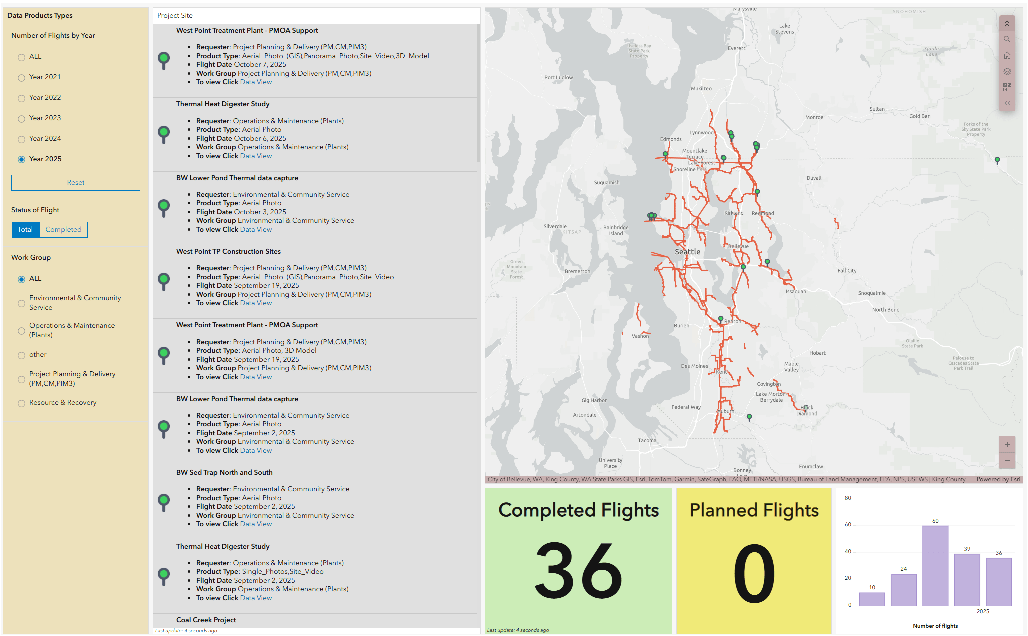
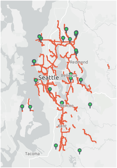
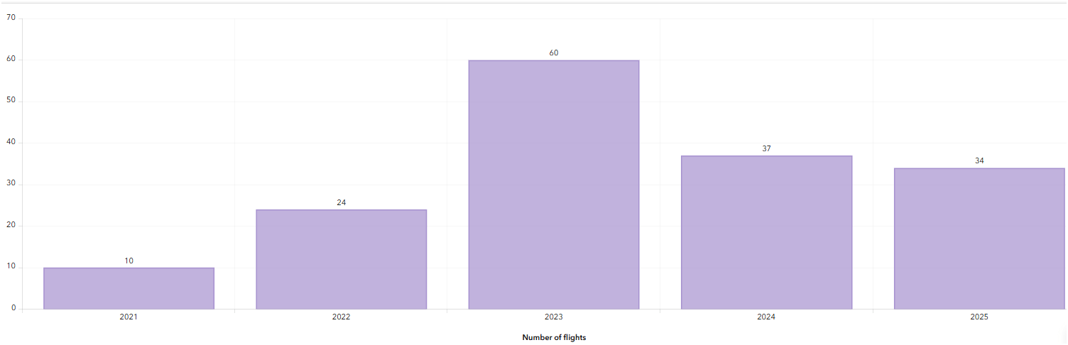
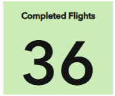
WTD Drone Dashboard


2021
June - Dec.
2023
Number of Flights
2022


2024
2025
Jan. - Oct.
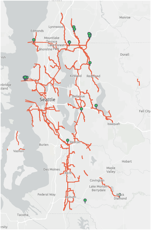
KC Wastewater Treatment Drone Program
People
+
Technology
+
Organization
=
Drone Program
BUT.....There are 17 county agencies support
King County GIS Data Library System
WTD
GIS Data:
The core of a GIS is its Database
Integrating Drones with KC GIS Center
Proof Of Concept
Lidar SLAM Handheld Unit

WHOA!
Just another tool in the toolbox


Famous Original Quote
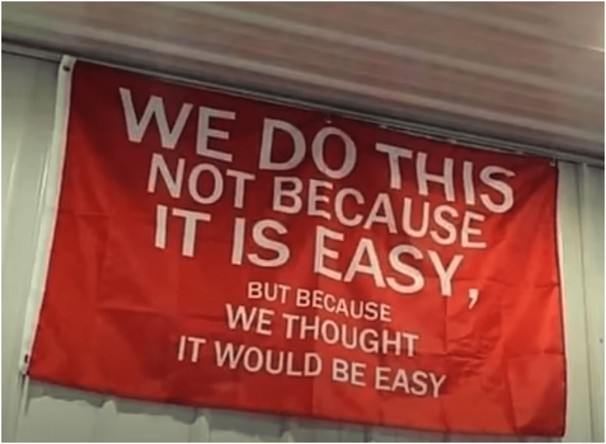
They Both are RIGHT!

END
for now
Thank You
peter.keum@kingcounty.gov

peter.keum@kingcounty.gov
King County Drone Summit 2026
By Peter Keum
King County Drone Summit 2026
Presentation for first King County Drone Summit 2026 - in person KSC 6th floor.


